
Flood Hazard Assessment and ProtectionWorking from BC Floodplain mapping of the 200 year flood level, the elevation of this flood can be surveyed on your property. Where this Floodplain mapping has not been done, the extreme flood level can be established from a combination of regional hydrology, flow records, river survey and hydraulic channel flow depth calculations, and the physical features around the floodplain. Once the extreme flood level is established, Gooding Hydrology can design and construct flood protection for your home, utilizing set-back dikes which protect the portions of your property necessary to protect, while allowing the maximum possible amount of the floodplain to remain functioning as floodplain. Allowing as much of the floodplain as possible to take over-bank flow during extreme floods reduces erosive pressures on the stream banks, reduces water levels during extreme flows, and creates a more natural morphological and biological functioning of river. |
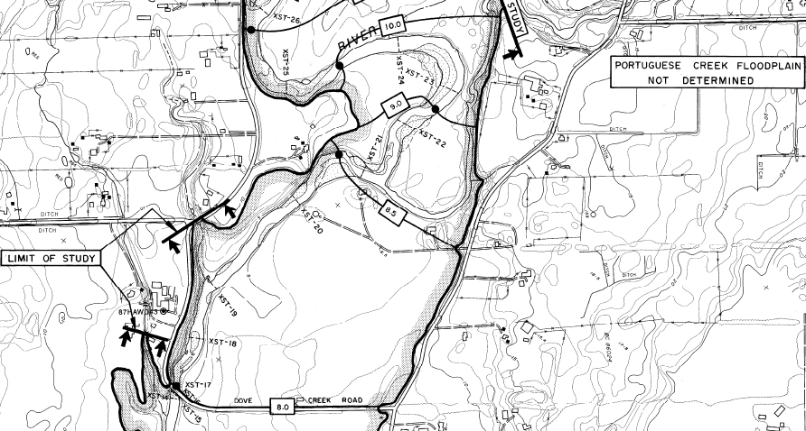
BC Floodplain Mapping
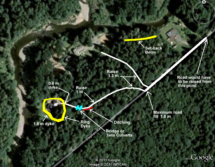
Typical Flood Management Plan
|
Dave Gooding, P.Eng., | 681 Rainbow Road, Saltspring Island BC, V8K 2M6 | Phone: 250 538-1869 | Email: dgooding@saltspring.com